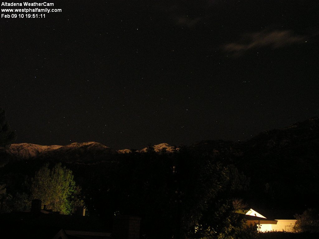
Photo: The Altadena Weathercam records snow at about 3800 ft. at about 8 PM tonight (Bill Westphal)
Carolyn Seitz shares this:
At this evening's conference call with the Incident Commanders, we learned the following things:
- During today's rains, there were no injuries, no damage and no reportable incidents attributable to flooding, mud or debris flows
- None of the debris basins breached their capacity today
- The Weather Service is indicating that there is another band of showers expected to arrive in the area around 11 pm tonight and it will be followed by a trailing cold front that is expected to produce thunder storms and showers with the potential for rainfall amounts at times up to 2 inches per hour
- Today's rainfall as measured in LaCanada/Flintridge was approximately 0.72 inches today
- All debris basins are draining and all inlet structures are being monitored 24/7 and cleared as necessary
- Crews from the Department of Public Works will continue to work to clear the mud and debris from the basins and inlet structures through the weekend, or as long as necessary
- While there are evacuation orders in place for La Crescenta, LaCanada/Flintridge and Acton, there are none in effect for Altadena except the Millard Canyon Campground
- There is still a possibility of additional rainfall on Saturday
- There are no further road closures for Altadena, except the one in place at the Chaney Trail gate
The news for today was better than all of the agencies planned and prepared for.
We owe our thanks to Supervisor Antonovich and his staff for making sure that information is being made available to all of us and for making sure that the communication and sharing of information among agencies is working well, and we owe all of the agencies our thanks for being ahead of the incident and for keeping us all safe.
Updated information on the status of the debris basins should be updated around 8 AM tomorrow by the Department of Public Works. You can find that information at www.dpwcare.org.
Stay safe!
Carolyn
And from Gino Sund, the view from the local briefing:
The day passed with no damage and no injuries in the burn area. Rainfall was relatively low and no basin overflowed. The latest forecast for tonight is for the last band of showers from this storm to pass over around 11:00 p.m. This event may include some heavy rain and possible thunder showers. Therefore the existing evacuations will not be lifted at this time. The forecast is for clearing by morning and if the weather cooperates the evacuations may be lifted at that time. No alerts for Altadena. This will be the last briefing for this storm event.
Meanwhile, with the possibility of another downpour later tonight, the National Weather Service has issued a flash flood watch:
...FLASH FLOOD WATCH REMAINS IN EFFECT FOR THE RECENT BURN AREAS UNTIL 3 AM PST WEDNESDAY...
THE FLASH FLOOD WATCH CONTINUES FOR* UNTIL 3 AM PST WEDNESDAY.
* THE RECENT BURN AREAS IN LOS ANGELES COUNTY. THIS INCLUDES THE STATION...MORRIS...AND SANTA ANITA BURN AREAS.
* SCATTERED SHOWERS AND POSSIBLE THUNDERSTORMS WILL CONTINUE TONIGHT. THERE IS STILL THE POTENTIAL FOR BRIEF HEAVY DOWNPOURS...WITH LOCAL RAINFALL RATES IN EXCESS OF .50 INCHES PER HOUR. THESE RATES ARE IN EXCESS OF THRESHOLDS DETERMINED BY THE USGS TO BE SUFFICIENT TO CAUSE FLASH FLOODING AND DEBRIS FLOWS IN AND BELOW THE RECENT BURN AREAS.


