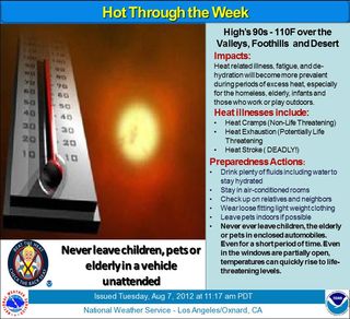
 This information passed on from the Altadena Sheriff's Station: look for temperatures well above normal thru the weekend:
SYNOPSIS: High pressure centered over the western U.S. will shift slightly westward to produce temperatures well above 100 degrees across inland portions of southern California through at least Saturday. High temperatures of 105-110 will occur Wednesday through Saturday in the inland valleys, deserts, and foothills. High temperatures in the coastal areas, such as downtown Los Angeles, will be cooler with daytime highs in the low to mid 90s, and in the 70s at the beaches. Fortunately, temperatures will cool at night to the 60s and 70s across even the areas with the warmest daytime highs. Relative humidity levels, meanwhile, may increase by the end of the week, which will produce increased heat index values (apparent temperature) in isolated areas of the inland valleys and foothills. This increase in moisture and resultant unstable atmosphere may also produce isolated thunderstorms over mainly the eastern portions of the Los Angeles County mountains and the Antelope Valley Friday and Saturday afternoons and evenings.
IMPACTS: Although most areas will be below excessive heat criteria thresholds, temperatures will still be well above normal across all areas except the near coastal zones. This is not uncommon for this time of year. Nonetheless, these conditions can be very dangerous to those partaking in outside activities, pets, and the elderly who may be without air conditioners. A secondary impact of this event will be the increased fire danger resulting from the isolated thunderstorms possible over mainly the eastern portions of the Los Angeles County mountains and the Antelope Valley. Vegetation has continued to dry over the summer, which increases the potential for fire starts due to lightning.
TIMING: Hot afternoon temperatures will peak on Thursday and Friday, and continue into Saturday. The high pressure system begins to shift eastward by Sunday for slightly cooler temperatures, then by Monday afternoon temperatures will cool to more normal readings as cooler onshore flow returns.
FORECAST CONFIDENCE: High confidence for hot temperatures inland, valley, and foothill areas. Medium confidence for increasing relative humidity levels and subsequent isolated heat index values 105 degrees and over. Medium confidence for thunderstorms Friday and Saturday due to the uncertainty over the amount of monsoon moisture and atmospheric instability.
Updates and statements about this heat event can be accessed on our web site at www.weather.gov/losangeles


